We have some of the most attractive best tourist places in Dhule district, which include , historical idols, rare historical artifacts in Farsi, Modi, Sanskrit, Marathi and Hindi, in the Rajwade Research Circle, Laling fort, Bhamer fort, Songir village close to Songir fort, Thalner fort, Akkalpada dam, and we provide information regarding these places, including addresses and locations.
List Of Best Tourist Place In Dhule
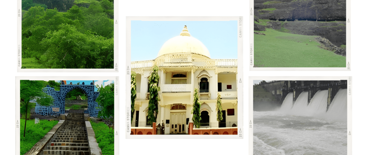
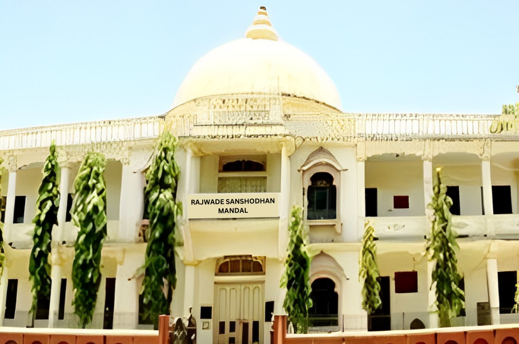
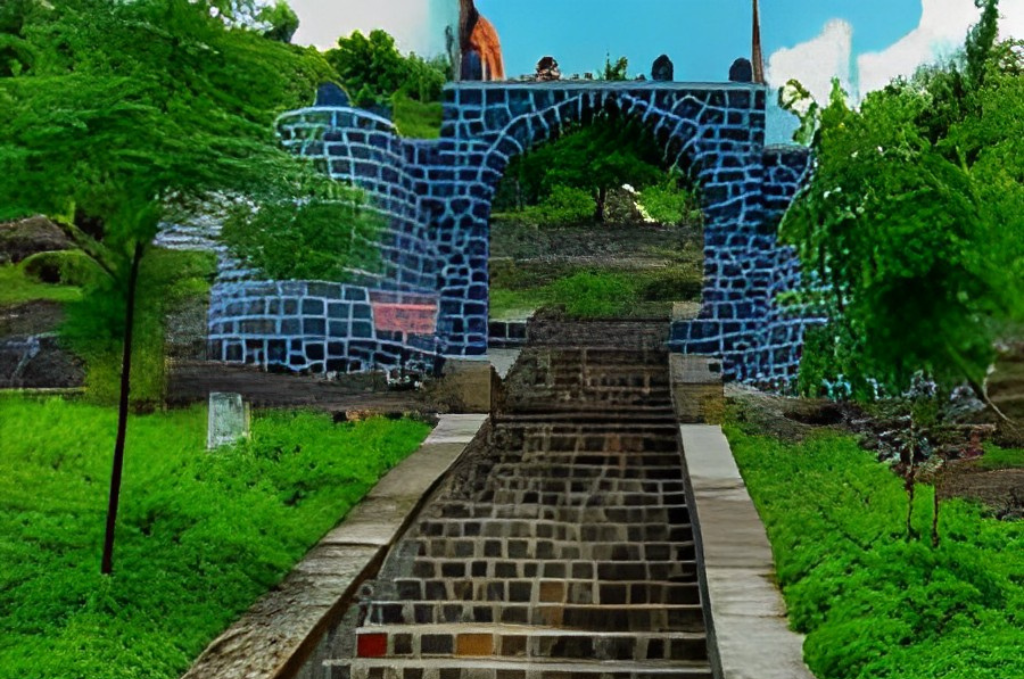
1. Rajwade Sanshodhan Mandal
As a result of disputes with Indian History Research Board officials, historian V.K. Rajwade moved to Dhule from Pune. During his twenty-six years stay there, he conducted historical research. During this tenure, he produced books that gave meaning to history and to the entire literary world.
History of downtown Dhule from the architecture of the V.K. Rajwade Board of Inquiry is standing. The story of this genre is that V.K. Rajwade began the work of preserving historical documents, books and making research and research available for scholars. Apart from this, there is a collection of documents, inscriptions, historical idols, rare historical artifacts in Farsi, Modi, Sanskrit, Marathi and Hindi, in the Rajwade Research Circle. There are researchers from all over the country who come to investigate here. There is also a Rajwade Research Council Library. Historian Rajwade died on December 31, 1926. At a meeting called to honor him so that his work in the field of research could continue uninterrupted, on January 9, 1927, his followers established the Itishacharya Research Board. To preserve the historical documents, the bibliographies collected by Rajwade and to make them available to researchers and researchers.
This library was established on January 9, 1927. The aim behind this is for the library to be used by scholars and professionals. At first, the number of books in this library, which had only two thousand five hundred books, gradually increased to 25 thousand. More than 750 members benefit from regular library services. The library being old has preserved rare and precious books. Both domestic and foreign scholars who come to do research can study the rare books in this library.
Address NH 211, Navnath Nager, Dhule, Maharashtra 424001
Location https://goo.gl/maps/eojzXhTLtXUm8TpY8
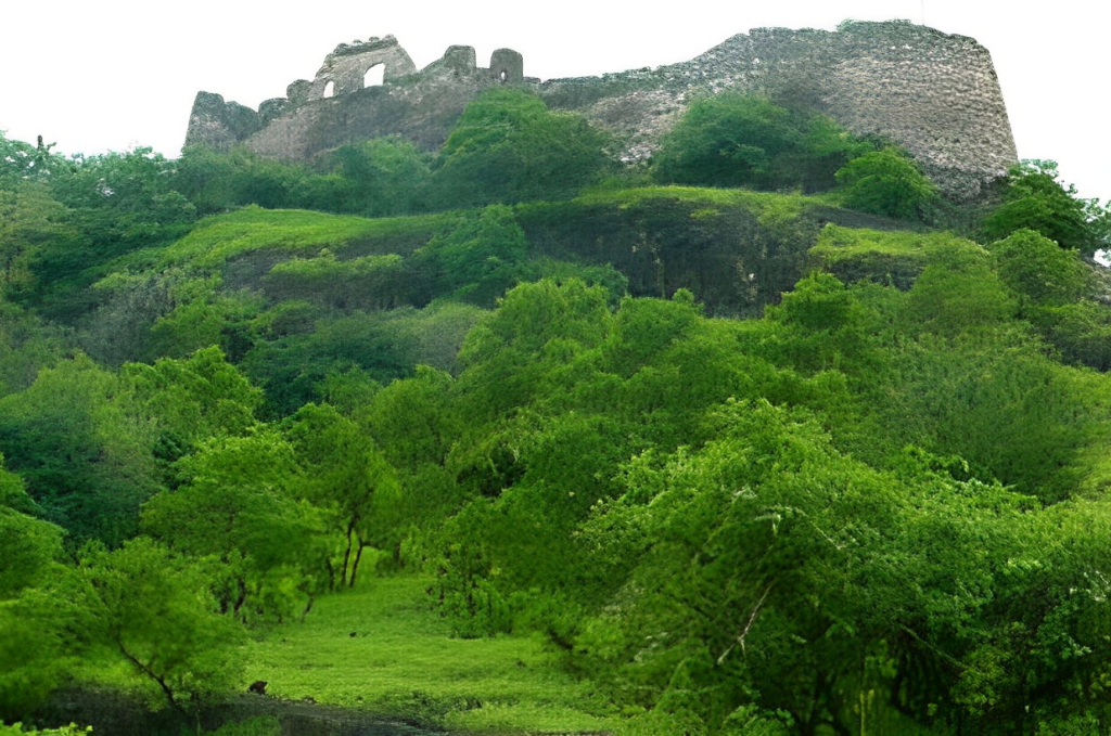
2. Laling Fort
Laling Killa is a small fort located in what is now Dhule district in the state of Maharashtra in India. The fort is located on top of Laling Hill, about 9.65 km south of Dhule town. It was one of the most important forts in the Khandesh region during the time of the Faruqi kings.
In Dhule, Taluka is known for an ancient ruined fort that occupies the hilltop. It is a place of considerable antiquity and the fort is believed to have been built during the region of Malik Raja Faruqui. Which was later granted to the eldest son. It was in this fort that Nasir Khan and his son Miran Adil Khan were besieged in 1437 by General Bhanrnani until relieved by an army from Gujrath. Laling also has two hemadpanti temples in a tinder state and a rained hemadpanti well.
Laling Fort or Laling Kila as it is popularly called in the regional dialect, Marathi, is a fortified military outpost which alternately serves as a guard post which was built in the early 19th century by the dynasty Faruqi. The fort takes its name from the top of the hill on which it stands, Laling Hill. Laling Fort has been mentioned several times in many travelogues and documented information regarding the whereabouts of the great Mughal horde during their expeditions into the Deccan as far back as the 17th century. In documented evidence, the fortress is found to be a stronghold with limited fortifications remaining in 1862.
Laling Fort is located south of Dhule city in Maharashtra and falls on the old Surat-Burhanpur trade route. It is in total disrepair and is almost dilapidated due to neglect and lack of attention to maintenance. It has borne the brunt of many climatic atrocities and withstood the impact of military attack through generations and complete neglect in its upkeep has caused the beautiful fortification to succumb to the test of time. It houses the remains of some rock-cut cisterns that functioned at one time as well as the remains of weapons used for its protection and surveillance. In addition to its historical significance, Laling Fort also provides the right platform for the best views of the city and the human settlement below. The detached section is to the south of the citadel where an entrance leads to the dam, which is semi-circular in shape, with a shadow called the Chhatri located nearby
Address National Highway 3, Laling, Maharashtra 424006
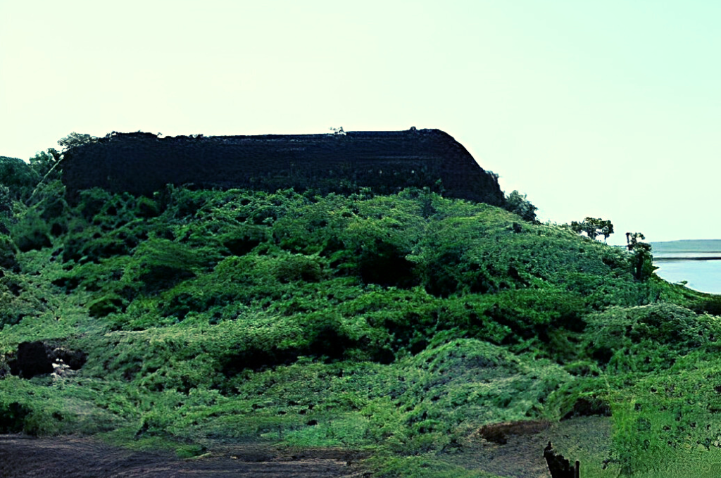
3. Songir Fort
After seeing Lalling forts, Dhule is a village on the Mumbai-Agra highway, north of Songir village, 19 km away. Songir village near a suvarngiri or songir fort. It is built in a very significance place. It culminates at 304 meters above sea level. Since 1370, information available for the fort de songir. This fort belonged to the Farooqi sultans. Later, it came under the control of the Mughals, the Marathas and successively the British. The British conquered it in 1818. The rounded black stone ramparts attract attention. There is some remains of this fort have also crash.
The fort consists of an old well and a reservoir next to the ruins of an ancient water system. Dhule is recognized for its Fort Songir, built in 1820, and contains an inscription of Ugrasen, son of Raja Mansingh showcasing Ugrasen’s bravery at its front door. Songir Fort consists of an ancient well and reservoir next to the ruins of an ancient water system. Dhule is recognized for its Songir fort which was built in 1820 and contains the inscription of Ugrasen, son of Raja Mansingh showcasing the bravery of Ugrasen at its front gate. This fort is on a small hill of Songir The entrance to the fort is in poor condition with only the main cornice remaining.
This fort is on a small hill of Songir The entrance to the fort is in poor condition and only the central computer remains. This gate had an inscription dated “Shake” 1497 (AD 1575) which stated that “Ugrasen, son of Man Singh was very brave”. This registration is now with the local government authority. Remains of pillars are visible along the entrance. There are steps in front of the entrance leading up and a water tank just below.
Address Songir TaL Dist., Dhule, Maharashtra 424001
4. Bhamer Fort
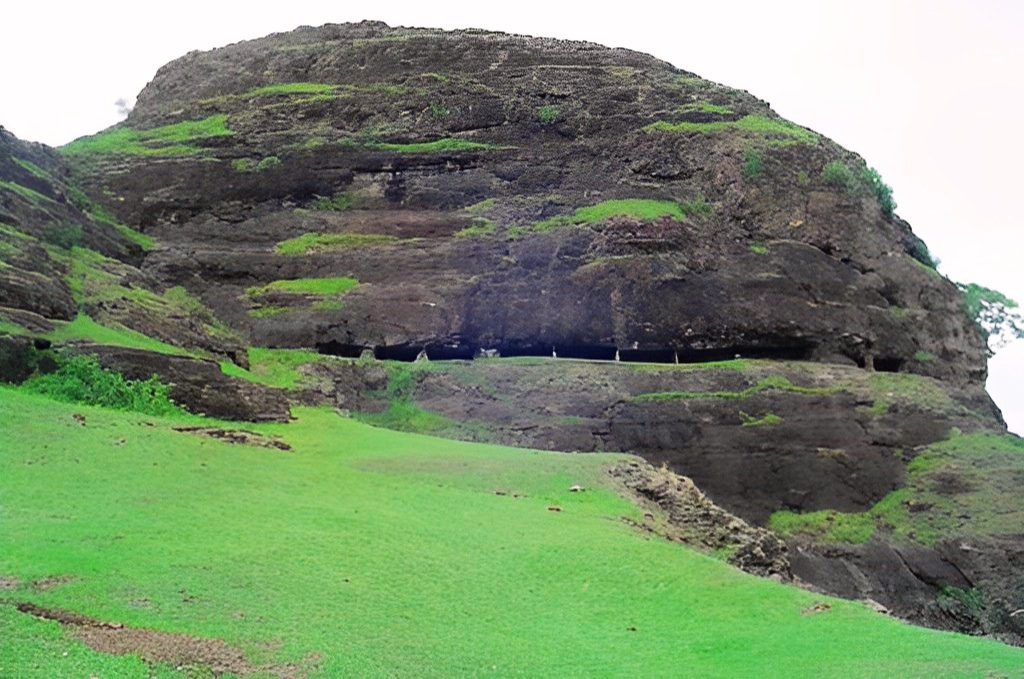
Bhamer village is known as bhamer fort and even more so for the caves or rather the dwellings of the monks which are found in the escarpments of the hills above the village. The fort located at the end of a range of rugged and rugged rocky hills is separated from the rest of the range by a man-made chasm. The natural escarpment of the fort overlooking the city has been reinforced in some places by masonry constructions. Although the hill is quite high, the ascent is easy and tortuous. On the south face is the entrance that gives access to the fort. Inside there are several cisterns of good water and also four large deposits excavated in the rock. There are many ruined entrances and gates and almost ruined towers. Time has also withered the artificial fortifications in many places. The city is believed to have been destroyed in punishing Kale Khan, a Muslim rebel, who captured it in 1736. It has never been restored to its original splendor.
This fort is a kind of Giridurg. The height from sea level is 2500 meters. The fort surrounded the village on three sides, while the gate on the fourth side and the gatehouse were being built. There are 184 caves in this fort. Some of them you can see caves. There is a water tank and a small temple in the fort. It is a fort that you have to visit once per fort. There is a mention of Captain Briggain’s removal of the column for the destruction of important buildings in Bhamer’s fort. At a distance of 48 kilometers from the city of Dhule and 13 kilometers from Sakri is the Bhamer Fort.
Address Bhamer TaL Sakri Dist., Dhule, Maharashtra 424001
Here We have provided the list of Best Temples In Dhule, You Can Enjoy your Holiday, !
5. Thalner Fort
Thalner is a Shirpur taluka market town on the banks of the Tapi River. It is on the Surat-Burhanpur highway. From Sultan Firozshah Tughlaq of Delhi, Malik Khan obtained the status of the neighboring regions of Thalner and Karvand. He took control of Thalner established the rule of the Faruq family and built a triangular-shaped fort at Thalner in 1370. The Tapi River was on one side, the fort was built on the other side by fortifications and towers. In 1600, the Mughal Emperor Akbar defeated Bahadur Shah Faruq and conquered the city of Thalener. Marathas won the fort from the Mughals.
The cemetery of the important people of the Faruki family, who ruled the Thalner fort, is located in the city of Thalner canton. They have inscriptions in Arabic. This includes the tombs of Malik Raja (1396), Malik Naseer (1437), Miran Adil Shah (1441), and Miran Mubarak Khan (1457). Thalner Town is on the Shirpur – Chopda road. Near here is the sanctuary of Aner known for its chinkara.
During 1128 AD, the control of this fort was with Jivaji and Govaji of the Gavli or Ahir family. The king of Devgiri, Bajirao’s son Daulat Rao attributed control of this fort to Jivaji and Govaji when he visited Thalner and noted that the fort was well maintained while the other 23 forts in the nearby area were in ruins.
In 1370 AD C., Ferozeshah Tughlak won the Khandesh region and appointed Malik Raja Faruki to administer the Gujarat region. Thalner became the capital center of it. The following year, the Sultan of Gujarat attacked Malik raja and captured the territory from him and Malik raja took refuge in Thalner’s fort. After he died in 1497 AD. C. control passed to his second son. This was against the wishes of the first son who, with the support of the Malwa sultan, attacked Thalner and took it under his control in 1417 AD. In 1418 AD the Sultan of Gujarat Mohammed Begada captured Thalner and plundered the neighbouring provinces and in 1511 AD he handed over half of the Khandesh region to his commander-in-chief Malik Hasanuddin. He was reportedly assassinated the following year.
Fort Thalner is located on the hill on the banks of the Tapi River where it takes a horseshoe bend. This hill is about 100 meters high. Unfortunately, the fort is now in ruins and only the 60 feet high brick wall near the Pataleshwar temple and two bastions are intact. However, all other structures have been dilapidated. There are two small temples in the fort of Goddess Saptashrungi and the other one is empty. Although there is not much to see in the fort, there are two places you can visit in the town.
Address Thalner Tal Shirpur Dist. Dhule Maharashtra
6. Aner Dam
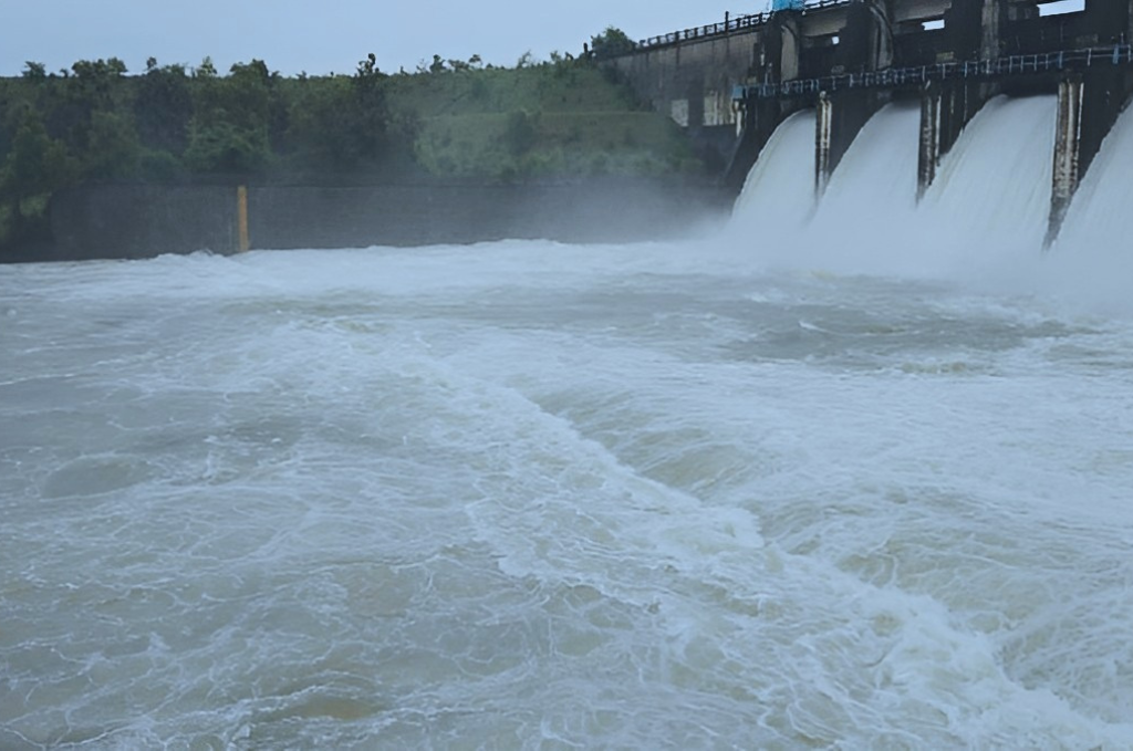
Aner Dam is an earthfill dam on Aner River and in Shirpur taluka, Dhule district in state of Maharashtra in India. The dam is 8 kilometers from Hisale village and 5 km is ganapur village which is situated near Shirpur-Chopda state highway in Shirpur Tehsil. Aner Dam Sanctuary is a popular tourist spot. The dam is bordering the villages of Aner Hisale Marathe Ganpur. The fishes of Aner Dam are famous in Jalgaon and Dhule districts. The locality is beautiful for twelve months becoze of satpuda parvat and the source of the river is in the satpura mountain range
Aner Dam, which was built at the foot of Satpuda mountain on the border of Jalgaon and Dhule district, was built between 1974 and 1978 and the water capacity of the dam is 216.40 meters. Medium Project) All ten doors are open till 15th August.
Address Hisale Tal Shirpur Dist. Dhule Maharashtra